70 Years at Hidden Lake

Part 3 of the History of the Hidden Lake area.

Friends of the Carp Hills recently interviewed Allyson Zeitz, Jennifer Zeitz, and Rosemary Zeitz, three of four sisters who grew up on a 250 acre farm in the 1960’s and 1970’s in an area now called Hidden Lake in the village of Carp.  Their farm was a “paradise” for learning about nature.  Over time the land was sold off for development.  Their story tells us how much this edge of the Carp Hills has changed over 70 years, but also how nature has adapted and learned to live in what remains.

The Farm Years:  1950’s to 1980’s.

Walter Zeitz immigrated from Germany in 1951.  He had a degree in genetics and animal husbandry and wanted to be a farmer.  He worked at the Experimental Farm as a research assistant and then at Health Canada.  He met Pamela, a nursing student, and they were married in Ottawa in 1953.

Pamela and Walter Zeitz in front of the farmhouse on today's Charlie's Lane near Hidden Lake in Carp.  Taken in 1966. (Zeitz family collection.)
Pamela and Walter Zeitz in front of the farmhouse on today’s Charlie’s Lane.  Taken in 1966. (Zeitz family collection.)

In 1956 they bought a 250-acre farm in Carp from Charles and Juanita Snelgrove.  (See our article from 2017:  Carp Memories of Juanita Snelgove.)  The farm stretched from modern day Juanita Avenue west to Holland Hill/Murphy Side Road and north to the Concession Line (roughly the location of the snowmobile trail).

Extent of former farm near Hidden Lake in Carp.
The Zeitz farm included what today is the west edge of the village:  Juanita Avenue, Charlie’s Lane, Snelgrove Drive, Ridgeview Drive, Hidden Lake Crescent, Seagram Heights,  and Hidden Lake Park. The original 1835 log farmhouse remains tucked behind Charlie’s Lane.  It was clad in brick in the 1880’s.

The farm originally had four historic log barns and a milking shed.  The long laneway to the house from Carp Road was lined with huge Elm trees, which eventually died from Dutch Elm disease.  Corn fields grew up to the edge of the wetlands where Hidden Lake houses stand today.  The family rented some land to Ted Carruthers, who pastured cattle on the Ridge into the 1960’s.

Large barn at the corner of today’s Ridgeview Drive and Charlie's Lane, circa 1950's, near Hidden Lake. (Photo from the Zeitz family.)
Large barn at the corner of today’s Ridgeview Drive and Charlie’s Lane, circa 1950’s. (Photo from the Zeitz family.)
Zeitz Pond in the 1970’s. (Photo by Pamela Zeitz.)
Looking north from the south shore of Zeitz Pond in Fall 1973. (Photo by Pamela Zeitz.)

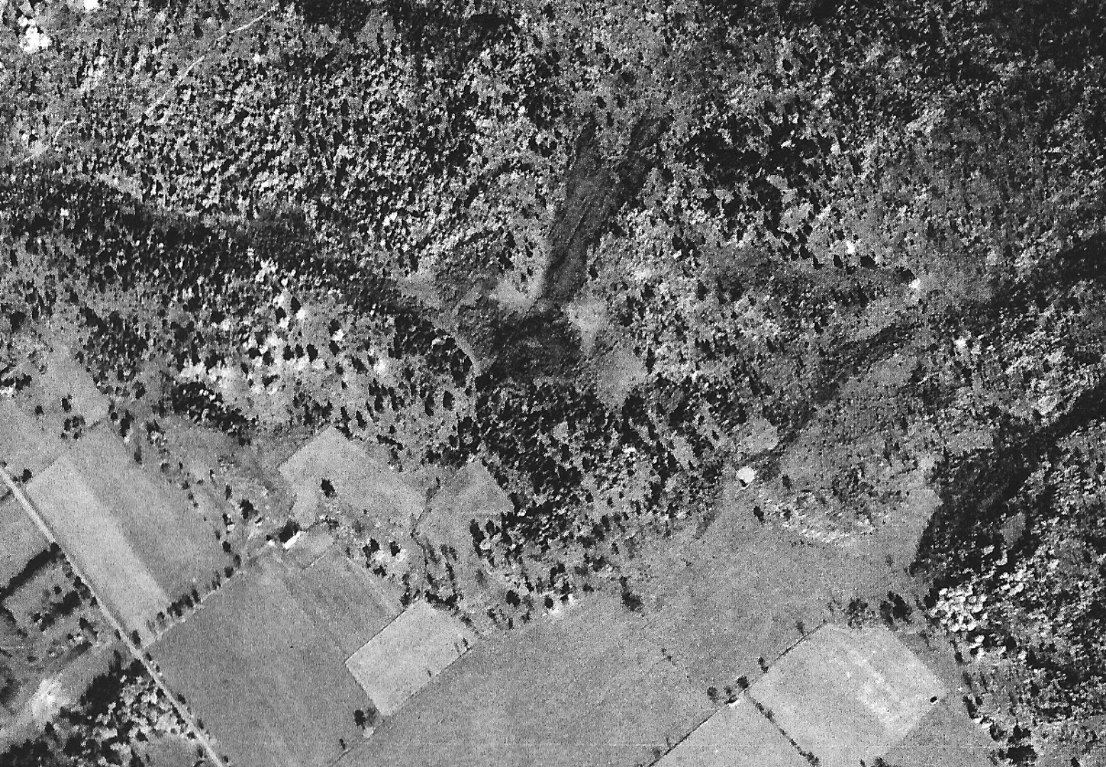
What today is called “Hidden Lake” is really a beaver pond.  Before the 1960’s it was a wetland, which can be seen from the 1945 aerial photo below.  Beavers disappeared in the Carp Hills due to trapping and logging.  In more recent times, a large brush fire burned the ridge in 1955.  (See our 2020 article Carp Ridge Fire History.)  Beavers returned to the area in the 1960’s and 1970’s when the cattle were removed.  Trees and vegetation regrew.  Conifers regrew around the large wetland, which became a pond due to beaver activity.  Trees that died when the wetland flooded became safe havens for Great Blue Heron nests.  The pond and its wetlands continued to expand until 1990 when nearby development drove the beavers out.  Today the pond is about 1.25 meters at its deepest point.

Aerial photo of Hidden Lake area near Carp in 1945 from the National Photo Archives.
Aerial photo from 1945.  The large barn and the laneway lined with Elm trees from Carp Road to the farm are visible in the lower left corner.  The outline of the Hidden Lake pond is clearly visible, but it is a wetland not a pond.  (National Photo Archives.)

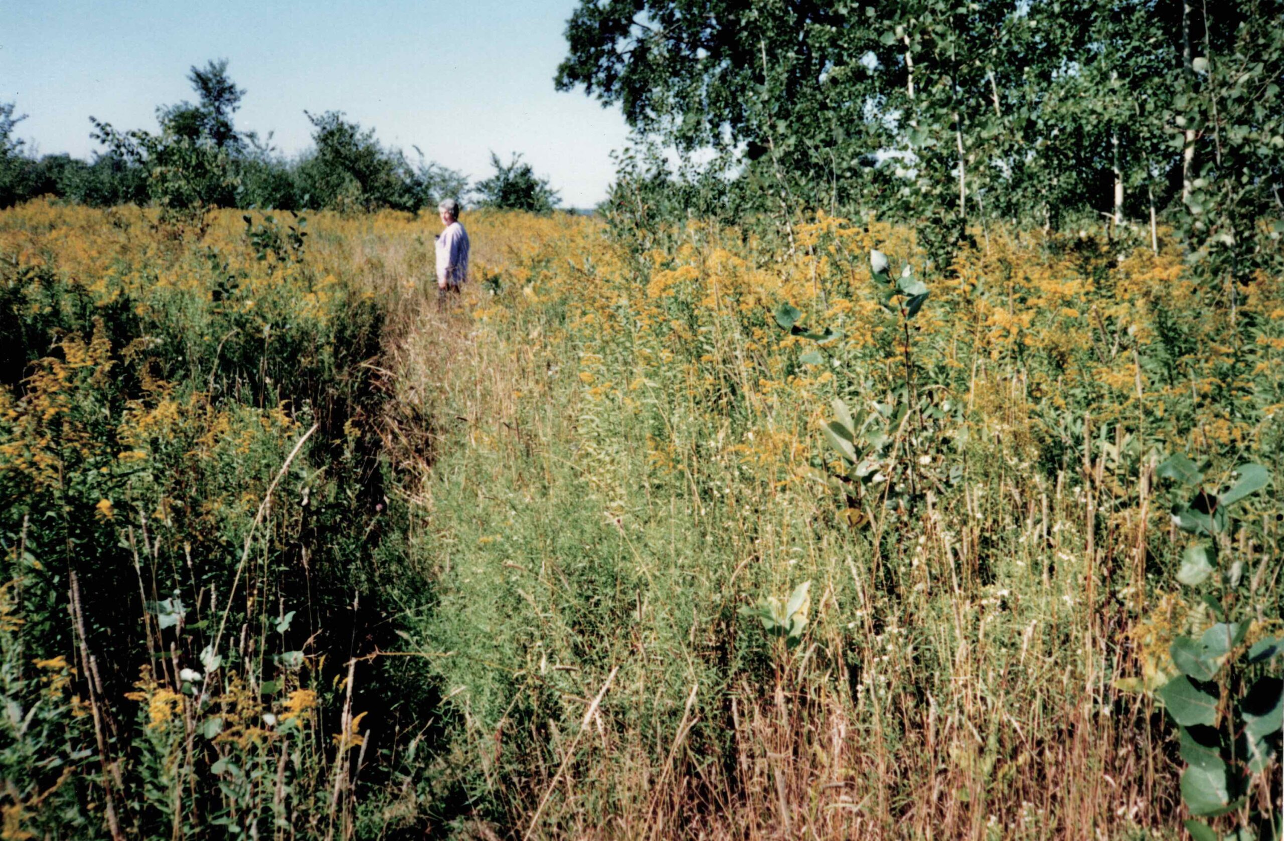
The sisters describe their parents as “environmentalists” and their farm as a “paradise” for learning about nature.  Recreation centred around the pond.  They had a rowboat for exploring it, they hiked around it, and they skied across it in winter.  Swimming was not an option due to the leeches.  The girls had a microscope and examined water samples.  They describe their mother Pam as a naturalist.  She painted landscapes and planted young trees on the farm taken from the woods by the pond.  She taught them about the plants and lichens.  And she volunteered at Huntley Centennial Public School to teach crafts.  She also hosted classes at the pond where the students collected leaves and other specimens for their craft projects.

Zeitz pond at Hidden Lake in Carp, painted by Pamela Zeitz.
Zeitz Pond painted by Pamela Zeitz.
Zeitz Pond photo that possibly inspired the painting, Fall 1973.  (Photo by Pamela Zetiz.)

They remember routinely seeing a lot of wildlife:  deer, porcupines, foxes, bears, and many birds.  Herons nested in a rookery at the north end of the pond.  Whip-poor-wills sang non-stop in the humid summer nights.  They could hear wolves and coyotes at night.  One year Walter Zeitz regularly saw a Canadian Lynx during his two- to three-hour daily rambles.  There were many frogs and salamanders, indicators of a healthy woodland ecosystem. 

When Walter Zeitz died in 2007, the family scattered his ashes in the pond.

Story from Rose.  I remember one Christmas (when I was in high school) my oldest sister Lisa was home from university for the holidays. It was a gorgeous evening and the full moon cast an amazingly strong light over the farmhouse. Lisa got this wonderful idea to go for a night ski. The two of us left and skied up to the pond. We reached the pond and then the wolves began howling. My sister was thrilled and I was terrified! She was fascinated at how close they were and confirmed they were indeed wolves. I didn’t waste any time looking for them and told her I was scared and going home. I literally flew over the snow to my Mum awaiting our return in the kitchen. I had my skis off a blanket around my shoulders and was sipping a hot drink by the time Lisa made it back. We laughed about that for years.

Carp Begins to Grow – the 1970’s.

The Zeitz’s sold their first parcel of land in the mid-1970’s in preparation to fund their four daughters’ university educations later that decade.  Developers built residences on a new road called Snelgrove  Drive.  Eventually houses were built to create Ridgeview Drive.

Elsewhere in Carp between 1976 and 1999, developers built new streets and houses on Cavanagh Drive, Glenncastle Drive, and Inniskillin Drive.

Carp in 1976. (GeoOttawa.)
Carp in 1999. (GeoOttawa.)

In the 1976 aerial photo above, new houses on Snelgrove Drive are visible.  Stubs for Juanita Avenue and Charlie’s Lane are created.  The brown field will become houses on Ridgeview Drive.  The Zeitz farm, laneway, and outbuildings are visible north of Snelgrove.  By 1999 the east side of Carp has grown substantially.

During this time, Carp still retained its small village vibe.  People asked permission to use the Zeitz property for cross-country skiing and were allowed to create a ski trail with markers that connected to a wider network.  The Zeitz family also allowed the local snowmobile association to create and maintain a trail on the northern edge of the property.

Today’s Hidden Lake Crescent in the 1970’s. (Photo by Pamela Zeitz.)
Great Blue Heron rookery at the north end of the Hidden Lake pond circa 1980's.
Great Blue Heron rookery at the north end of the pond circa 1980’s. The trees died when the wetland became a pond, creating an ideal habitat for herons to nest. Eventually the trees rotted and fell into the water, all part of the lifecycle of a beaver pond. (Photo by Pamela Zeitz.)
Paradise Lost – the 1990’s and 2000’s.

Major changes came after the Zeitz family sold a second parcel of land in the 1980’s.  

View looking north toward the pond to what would become Hidden Lake Crescent, circa 1980's. (Photo by Pamela Zeitz.)
View looking north toward the pond to what would become Hidden Lake Crescent, circa 1980’s. (Photo by Pamela Zeitz.)

Hidden Lake development finally began on the second parcel in the late 1990’s with clearing of land near the pond.  Hidden Lake Crescent, Charlie’s Lane, and Seagram Heights were built over a period of 14 years and were mostly complete by 2014.  Carp was also growing in other areas, adding Jensen Court, Frances Colbert Avenue, and the beginning of a new development on Meadowridge Circle off Donald B. Munro Drive.

Near the Carp Hills: Hidden Lake area in 2014.  Most of the new development just south of the beaver pond is complete.
Hidden Lake area in 2014.  Most of the new development just south of the beaver pond is complete. (GeoOttawa.)

Both sisters remember how the clearing of land south of the pond affected wildlife.  The beavers left.  Rose saw a fox family disoriented by the tree cutting and blasting as the land was levelled.  Wildlife retreated deeper into the Carp Hills.

As the village’s population increased, unauthorized use of the family’s remaining large property around the pond became a problem.  Developers falsely told buyers that they had access to the Zeitz’s land.  No trespassing signs were ignored and removed.  Trails were created.  Garbage was left.  Campfires became a problem.  Illegal duck hunting occurred without landowner permission and too close to houses.   Someone even installed pipes to try to drain the pond

Hidden Lake in Carp: Seagram Heights in the 1980's.  (Zeitz family photo.)
Seagram Heights in the 1980’s.  (Zeitz family photo.)
Pamela Zeitz at the Hidden Lake pond in the Carp Hills.  (Photo from the Zeitz family collection.)
Pamela Zeitz at the pond.  (Photo from the Zeitz family collection.)

Eventually Pamela Zeitz decided to sell their final piece of paradise.  In 2015 a young farmer who shared the family’s land stewardship and conservation values bought the 121-acre property surrounding the pond and built a house.  (Read our 2018 post about Hidden Lake’s new resident.)

Pamela Zeitz passed in 2021 at the age of 96.

Hidden Lake Today

As noise and traffic from construction abated, birds and animals returned to the land around the pond, albeit in lesser numbers and diversity, and adapting to human presence.

  • Signs of recent beaver activity are visible along the path in Hidden Lake Park.
  • The park is an eBird hotspot with over 130 bird species recorded. Great Egrets and Great Blue Herons stalk the shoreline for crustaceans, frogs, and fish.
  • River otters frolic in the pond, indicating there must be a healthy population of fish and amphibians to sustain them.
  • Painted turtles, Snapping turtles and threatened Blanding’s turtles emerge to lay their eggs where they have for decades in what are now lawns and gardens.
  • Coyotes patrol along the woodland edges and in backyards.

Allyson Zeitz muses philosophically about the changes she’s seen at Hidden Lake. “Changing times, changing needs, and a changing landscape most certainly, but always an incredibly beautiful place to be observant of the natural world.”

Coyote in a backyard on Charlie's Lane in Hidden Lake in the Carp Hills, 2018.  (Photo by Josée Leblanc.)
Coyote in a backyard on Charlie’s Lane, 2018.  (Photo by Josée Leblanc.)
Blanding’s turtle looking for a nesting site at the entrance to Hidden Lake Park, 2022, in the Carp Hills.
Blanding’s turtle looking for a nesting site at the entrance to Hidden Lake Park, 2022.
Signs of recent beaver activity at Hidden Lake Park in the Carp Hills, 2022.
Signs of recent beaver activity at Hidden Lake Park, 2022.
Hidden Lake south of the beaver pond, circa 1970’s, where houses stand today. (Photo by Pamela Zeitz.)
Learn More
Hidden Lake Park in the Carp Hills.

Hidden Lake Park is a 5.6 hectare (14 acre) park with a 650 meter gravel pathway. It provides the only public access to the former Zeitz farm.

We are publishing an interpretive guide to the park this year.

Part 2 of the History of the Hidden Lake area: Carp Memories of Juanita Snelgrove – We interviewed Juanita Snelgrove in 2017 when she was 101 years old.  Read about her memories on the farm before the Zeitz family and about the fire of 1955.

Carp Ridge Fire History – Our 2020 article about fires in the Carp Hills.

Hidden Lake’s New Resident – Our 2018 article about the purchase of the final parcel of the Zeitz farm.

Beavers: Partners in Wetland Management – Our 2020 article about the importance of beavers to the Carp Hills.

Coming soon – Part 1 in our Hidden Lake area history trilogy about the farm below the pond when it was owned by the McCord family from the 1830’s through to the Snelgroves in the 1950’s.

All Aboard! Nature Excursions to Carp by Train in the 1890’s and 1900’s

History of the Hills – Part 6

People have been drawn to Carp’s natural beauty and its unusual geology for over 100 years.
 
The Ottawa Field Naturalists’ Club (OFNC) made the village of Carp and the Carp Hills an excursion destination at the turn of the twentieth century.  This was thanks to the railroad, which started regular service to Carp in 1893.  As documented in the 1896/1897 edition of OFNC’s transactions (1), the Ottawa, Arnprior, and Parry Sound Railway opened up new areas for the naturalists to explore with day trips all around the Ottawa and West Quebec area.  There was even local interest in establishing a branch of the OFNC in Carp, but this initiative never came to pass (2).
 
Founded in 1863 and the oldest natural history club in Canada, OFNC had many members who were distinguished scientists and researchers, often employed by Ottawa area government institutions.
 
OFNC’s interest in Carp started with geology and paleontology.  Geologist Dr. Henri-Marc Ami of the Geological Survey of Canada made visits to Carp in 1894/1895 (3) and 1896/1897 (4) to collect fossilized shells at an exposed sand/gravel stratification just south of the Carp Station.
 
The club organized two major excursions to Carp by railway in June 1905 (5) and in May 1909 (6). Members were interested in birds, insects, plants, and geology.
 
The famous Canadian naturalist and self-taught botanist, John Macoun, made a number of comments about the plants in the 1905 trip.  He also made a very perceptive observation about the similarity of the Carp Ridge flora to that of Kingsmere in the Gatineau Hills.  Both are part of the same Precambrian Shield formation.  We know that Macoun returned to Carp in 1907 and 1908, because there are lichen samples by him preserved by the Canadian Museum of Nature’s herbarium (7).
 
Local people made the club welcome and allowed access to their properties.  In the 1905 account, references are made to the properties of Mr. Johnson and Mr. Wilson.  It is thought that Johnson is a typo; it should be a Johnston, as the Johnston family owned land in Carp.  The 1879 Belden Atlas (8) shows the Johnston and Wilson properties adjacent to each other (Figure 1). The Diefenbunker is located on a portion of the former Wilson property where a sand pit was once operated.

Figure 1. From the 1879 Belden Atlas, this shows the village of Carp and the properties owned by Wilson and Johnston to the northwest of the village. The dotted line to the left of the Wilson property is today’s Craig’s Side Road.

We have annotated a 1945 aerial photo to illustrate places mentioned in the excursions (Figure 2).  This can be compared to an aerial photo from 1976, which shows the Diefenbunker (Figure 3).

Figure 2. This is an aerial photo from 1945, which has been annotated to show where points of interest were located in the early 1900’s. Road names are those from today. The portion of the Wilson property northeast of the Carp River became the Diefenbunker. (Source: National Photo Archives.)

Figure 3. Aerial photo from 1976 shows the Diefenbunker and its sewage lagoon on what was part of the Wilson property. The white lines are where roads and houses are located today. (source: GeoOttawa).

The Carp Station was located on Salisbury Street, which today is an undeveloped lot by the railroad tracks (Figure 4).  The club members walked from the station to today’s Donald B. Munro Drive, up the Carp Road hill to the school, which was located on Carp Road by Falldown Lane.  From there the club members walked to the Johnson (Johnston) property to view a grove and then visited the sand pit at the Wilson property.  It is believed that the grove refers to what people called the “picnic grounds”, which was also the first location of the Carp Agricultural Fair (9).

Figure 4. The location of the former Carp Station on Salisbury Street, now a vacant lot by the railroad tracks. (Photo: J. Mason)

The 1905 article mentions skirting the “Laurentian ridge” (Carp Ridge, part of the Laurentian formation) on the return to the station.  Here they viewed a mica vein, which is likely the small pit located at today’s Hidden Lake Park.  There was quite a bit of excitement about “curved hornblende crystals” taken at the vein of mica, which led to a separate article in the club’s journal, The Ottawa Naturalist (10).
 
No further trips to Carp by the club are mentioned after the one in 1909.
 
If anyone has more knowledge about the sand/gravel pit south of the station, the visited properties, and where the club may have gone, we’d love to hear from you.


References
 
OFNC’s publication, The Ottawa Naturalist, is available on-line from 1879 to 1919.  The publication then became The Canadian Field Naturalist with a national focus.  You can find these on OFNC’s web site.

(1)  “The Geology of the Ottawa and Parry Sound Railway”, The Ottawa Naturalist, Vol X, 1896/1897, pages 164-173.. A fascinating account of Ottawa Valley geology from downtown Ottawa to Barry’s Bay in 1896 by railroad.  Note the reference to the beauty of Chats Falls, a sight we can’t see today due to its being dammed for hydro electric power.
https://www.biodiversitylibrary.org/page/30104109
 
(2) Excursions Committee Report, The Ottawa Naturalist, Vol XXVI, 1910/1911, page 11.  Failure to establish an OFNC branch in Carp.
https://www.biodiversitylibrary.org/page/1607416

(3) Geological Notes, The Ottawa Naturalist, Vol VIII, 1894/1895 , pages 121-122 .  Documents a visit by H.M. Ami to a sand/gravel pit south near the Carp Station to collect shells.
https://www.biodiversitylibrary.org/page/1837466 
 
(4)  “Last Excursion of the Season to Galetta”, The Ottawa Naturalist, Vol X, 1896/1897, p. 141.  A short stop at the Carp Station to collect shells on the way to Galetta and Marshall’s Bay.
https://www.biodiversitylibrary.org/page/30104077
 
(5)  “General Excursion to Carp”, The Ottawa Naturalist, Vol XIX, 1906/1907, pages 91-94.  An account of the 10 June 1905  excursion to Carp.
https://www.biodiversitylibrary.org/page/30104257
Here is a PDF of the “General Excursion to Carp” article that you can download.
 
(6) “Carp, Ont.”, The Ottawa Naturalist, Vol XXIII, 1909/1910, pages 81-84.  An account of the 29 May 1909 excursion to Carp
https://www.biodiversitylibrary.org/page/823273
Here is a PDF of the “Carp, Ont.” article that you can download.
 
(7) Lichen Portal – You can search for historic lichen observations in the Carp Hills at this site.

(8) Illustrated Historical Atlas of Carleton County, Ont; H Belden & Co: Toronto, 1879. (Facsimile edition printed 1971).
 
(9) Peg Blair – Huntley Historical Society – phone discussion on 6 July 20.
 
(10) “Carp Ontario”, The Ottawa Naturalist, Vol XIX, 1905/1906, pages 211-212.  Further geological information from the 10 June 1905 excursion about curved hornblende crystals:
https://www.biodiversitylibrary.org/page/30104377

The Carp Ridge in 1879

History of the Hills – Part 5

FCH board member and retired librarian Anne Wong found this eloquent account about the Carp Ridge/Carp Hills in the well known “Belden Atlas” published in 1879.  Written in the flowery language of the time, it describes how the “mountainous” outcrop in the northern corner of the township is the same as the Laurentian formation in Quebec (the Gatineau Hills are part of this formation).  The “Upper Road” is now called Carp Road.

“Reference has previously been made to the exceptionally poor character of the northern corner of the [Huntley] Township.  This formation is rather peculiar, being a spur of the Laurentides, which cross the Ottawa [River] at the foot of the Chats. Here there are portions which are quite approaching that character which might be termed mountainous, the only part of the Township where the topography exhibits an exceptional elevation.  These mountains are almost entirely of rock, in places as smooth as a dancing-floor for acres in extent, in others crossed and cut up by deep seams, in others again there are masses of huge size and every conceivable shape, piled in such form as to make acre after acre inaccessible even to the foot of a mountain-goat; in still other places the upheaval, which has evidently left the surface as it is, many cycles of time prior to the “creation of man,” has placed the molten strata in regular order and at various angles of inclination to the zenith; while everywhere the plainest evidence of tremendous heat are apparent, which, gradually dying out, left broad areas in the condition first described, which seems to have varied to the other names forms  by the occasional bubbling out, as it were, of the gases generated within the molten mass after the surface had become cooled.

This interesting formation runs down to the north-east limit of the Carp [River] Valley, and the peculiarity of the division is not less marked than the character of the divisions themselves. What is called “the Upper Road” from Carp Village to Fitzroy Harbor passes along the base of the mountain; and for miles – in fact all the way to the Fitzroy line and beyond – one can reach out the hand on one side and touch the forbidding rock of the mountain, which rises in many places very abruptly, and in others more gradually, to a height of several hundred feet; while a single step toward the other hand places him upon the gently descending and beautifully even plain which finds its lowest point at the edge of the Carp River, whose gliding, glittering stream can be seen for miles winding its way along its peaceful course, and flanked by a country which, though limited in extent, has no superior in excellence or in the attractiveness of its landscape, or general effect in this whole land of mountain and valley, and forest and stream, and rich fields, pleasant hamlets, and happy homes.”

Illustrated Historical Atlas of Carleton County, Ont; H Belden & Co: Toronto, 1879. (Facsimile edition printed 1971) p. 262.
 

Geological Survey of Canada Map 1508a shows the similarity of the Precambrian Shield formations of the Gatineau Hills and Carp Hills.  Download the map and read more about the geology of the Carp Hills here:  https://carphills.com/?page_id=1750

Carp Ridge Fire History

With a Masters in Library Science, FCH Board member Anne Wong had the skills and experience to research information about the two large fires in 1955 and 1870 that have swept our area in recorded history.  For her article she visited the National Air Photo Library and used the Huntley Township Historical Society’s resources at the Carp Library.  She also interviewed William (Bill) Bell, Ottawa Fire Service, Sector Chief, District 6 about current wild land fire management, which is particularly relevant for area residents who live near brush that becomes tinder dry during drought conditions like those in 2012 and 2016.

The Carp Bush Fire of 1955

Carp Hills (aka Carp Ridge)


The Carp Hills extend from March Road to Kinburn Side Road and are bounded by Marchurst Rd and Carp Rd.  The landscape is currently forested and sprinkled with marshes, bogs, fens, and ponds; a verdant wetland.  But it is not an old forest. 


The Carp Hills brush fire of 1955 began in Kinburn.
The 1955 brush fire began in Kinburn, about 4.5 km from the Carp Hills. (Map from Google Earth.)

The Carp Bush Fire of 1955 began in Kinburn.  The Ottawa Journal of Monday, 25 July 1955 reported that lightning struck a tree on the farm of H E Cary, near Kinburn.  It smouldered for about a week before bursting into flames on Friday, 22 July 1955.

By Monday, 25 July approximately 1500 acres had burned.

The fire burned so brightly that red flashes could be seen at the Britannia Yacht Club.

Smoke over the village of Carp was said to be visible up to 10 miles distant.

Bulldozers, brought in from Arnprior by Sam Bond, were used to create trenches, however the fire succeeded in jumping these and continued its destructive path, aided by the wind.

Farmers and volunteers from the area fought the fire using axes, shovels, beating the flames with brush, and hosing the flames with hand-operated stirrup pumps. Water was delivered by trucks to the pumps at the base camp created at Holland Garage –  located north of Carp on the exhibition ground road. 

The fire frontage was 5 miles wide and burned through the forest in Huntley, but also in March, Fitzroy, and Torbolton Townships

The wives of the fire fighters and the women of the village of Carp were intrinsic to the effort – providing food and beverages.  Young men were actively involved in the fire fighting effort

The fire destroyed valuable timber, estimated by one logger at the time to be worth $375,000.  “An average acre of pine was worth $250.” [The Ottawa Journal]

This, however, was not the first fire to ravage the Carp Hills. Nor was it the most devastating.

Photo from 1955 before the fire. The stub of what would become Thomas Dolan Parkway is in the lower left corner. (National Air Photo Library, A147550-062.)

Photo from 1959 four years after the fire. The stub of what would become Thomas Dolan Parkway is in lower left corner. (National Air Photo Library – A16525-052.)

The Great Fire of 1870

On 14 August, 1870 the Ottawa Citizen wrote about severe drought – “the consecutive rainless days was something unparalleled in the history of the country”.  Rain had not fallen in the Ottawa Valley for several months.

The Great Fire of the Ottawa Valley began in 17 August, 1870. Accounts vary as to the cause of the fire. The Carleton Saga suggested, “There  seemed to be no definite origin to the fire, or rather series of fires, that spiralled from such widely separated sources….” Another newspaper report indicated that it started as a controlled burning of brush by a railway crew.  High winds from the southwest blew flames into the tinder dry forest near Pakenham.  Wind speeds increased to gale force and the fire spread quickly through spruce and pine trees on the limestone ridges; engulfing Lanark, Fitzroy, Torbolton, March, and Huntley Townships.  It  was erratic; burning through and along cedar fences, skipping over areas and fields, yet burning through wide swathes of forest and fields.  The unpredictability of the fire burnt farmhouses, barns, and outbuildings; but left other buildings nearby intact.  Travelling at 10 miles per hour, at one point the fire stretched from Almonte to the Ottawa River, thoroughly engulfing the Carp Ridge, but oddly sparing the village of Carp. 

A first person account given by Christie Graham,  recorded by John Graupner in 1945, tells of how the Graham family loaded a hay wagon with their belongings and drove it into the Ottawa River.  

“The Great Fire of 1870 flattened much of western Carleton County in that one day in August.” [Curry, Terrence M.] The valuable timber that once covered Huntley Township was completely obliterated. [ H Belden & Co]

The forest coverage that exists today on the Carp Ridge is a mixture of oak, beech, maple, ash, ironwood, bitternut, fir, and pine. There are cedar stumps, gently decaying that are remnants of the former coverage. 

Two large, old cedar stumps in the Carp Hills, which may be remnants from the fire of 1870.


Thuja occidentalis: Cedar stumps can persist for well over a hundred years and if they have been burned somewhat by passing wildfire.  This evidence may be preserved for a similarly long duration.” – Owen Clarkin, OFNC Conservation Chair.

Current Wildland Fire Management

In any woodland area, fire prevention is the preferred way to prevent a catastrophic event.  The Ottawa Fire Services (OFS) has an active program of public education, part of the Fire Smart Program – firesmartcanada.ca . 

Should a fire develop in rural Ottawa, the OFS have been trained in the best methods of suppression.  In conjunction with the Canadian Wildland Fire Strategy; Ottawa’s fire fighters have the training, equipment, and certification  to tackle a woodland fire. Additionally, In 2014, OFS received accredited agency status with the Commission on Fire Accreditation International (CFAI), becoming one of only six (6) accredited agencies in Canada.  “Accreditation is an international recognition of achievement. It shows to your community that your agency is performing to industry best practices and is holding itself accountable through an external peer review…. Accreditation is valid for five years”. https://cpse.org/accreditation/faqs/

The initial call for a wildland fire will dispatch a pump truck, tank truck, brush truck, and the sector chief.  The first officer on the scene of a fire assesses the wind speed, property at risk, people in the area, and the possibility of missing people. Depending on the evaluation, additional resources will be requested.

Ottawa Fire Stations are equipped with pumper trucks, tankers, ladder trucks, rescue trucks, boats, brush trucks, gas powered floating pumps, and ATV’s; distributed throughout the urban and rural area. Each of the 12 rural stations is provides a specialty, with five of the stations having special brush trucks to combat brush and grass fires.   Brush Truck 63, acquired in 2019,  is located in Constance Bay and is a key piece of equipment for tackling grass and wildland fires.  Every Pump truck is outfitted with a forestry pack including 400’ of Forestry hose that is capable of being attached to additional hoses to extend the reach. On the ground tools include flails, chain saws, axes, and shovels – the same implements that would have been in use in 1955 and 1870 (except the saw would have been manual).  

What is definitely new in the arsenal is the use of drones to assist in fire fighting. Drones.  Using high definition cameras and infrared, fires (and people) can be located in remoter areas.  With high resolution cameras, the type, size and location of a fire can be determined. 

The personnel who could be called upon to fight include over 900 urban fire fighters and just under 500 volunteer fire fighters in the rural areas.  The volunteer fighters have the same training as the career fighters and all are National Fire Prevention Association (NFPA) certified.

In a worst case scenario, the Ministry of Natural Resources has water bombers stationed in Thunder Bay with satellite landing areas throughout the province.

And it may seem madness to have a Burn Ban in the Spring, there is method behind the decree:

While the ground may be soggy from the winter snow melt, the tips of the grass are dry.  When they catch fire, it rolls across the top of the ground – spreading rapidly

Additionally, the wet and soaked ground limits access for fire fighting vehicles. Just sayin’.


Information for this article was sourced from the following:

A brief account of the late conflagration near Ottawa August 17, 1870: Copied from the Ottawa and other papers : A collection of newspaper articles written at the time of the fire describing it in Huntley Township and the Ottawa area;  Huntley Township Historical Society. September 1992

Carleton Saga; Walker, Harry & Olive. 1968.

Gallant Grahams of Canada; Graupner, John.

Illustrated Historical Atlas of Carleton County, Ontario; H Belden & Co. 1879. (Facsimile edition printed 1971).

National Air Photo Library.

Ottawa Free Press; 25 August 1870.

Ottawa Journal; Monday, 25 July 1955.

Ottawa Valley’s Great Fire of 1870: The 19th Century Press and the Realty of a Great Disaster; Curry, Terrence M. 2009.

https://ottawa.ca/en/health-and-public-safety/ottawa-fire-services/about-ottawa-fire-services#fire-station-locations

Thank you to William (Bill) Bell, Ottawa Fire Service, Sector Chief, District 6 for the information about the Ottawa Fire Service and to the reference librarians at the Ottawa Public Library for their assistance.


Read More

Carp Brush Fire Latest in Long, Dry Summer (2012) – Ontario Association of Fire Chiefs.

Hidden Lake Fire in 2015 – link no longer available.

Hidden Lake Fire in 2020 – West Carleton Online.

Carp Memories of Juanita Snelgrove

Part 2 of the History of the Hidden Lake area.

In December 2017, FCH board member Judy Makin interviewed Juanita Snelgrove, then 101 years old, to listen to her stories about Carp and the Carp Hills.  Those who live in Carp will recognize the roads named after Juanita and her family:  Snelgrove Drive, Juanita Avenue, and Charlie’s Lane. Written by Judy Makin with help from Karen Pritchard, the article below was approved by Juanita’s daughter Meg Colbourn.
 
 
Juanita’s great great grandfather was Hamnett Pinhey, from England, one of two founding families of March Township, along with the Sparks.  Juanita’s mother was a Pinhey.  Juanita is the fifth generation; she now has great grandchildren.  (See book “Looking Back”, written by Naomi Hayden-Slater – a cousin – for the history of the early families.)
 
Born May 20, 1916 in Brighton, England, Juanita is now aged 103 years old. Her mother had been a nurse in Canada; travelled to England to make an art tour of the “continent” (Europe), but World War IMem started and interrupted her plans.  Nevertheless, she married and had Juanita. Her parents divorced when she was aged 2 years.
 
Juanita grew up with her grandparents in Hudson, Quebec, near Montreal. She and Charlie Snelgrove were third cousins, introduced by Charlie’s sister Eleanor who travelled to Montreal for university.  Eleanor looked up her relatives, including Juanita’s grandmother, and invited Juanita back for a visit to Carp. Juanita married Charlie Snelgrove in May 1950. She felt that there was initially a somewhat negative reaction to her in the village, as locals saw her as an “imported” bride from Montreal.
 
Juanita and Charlie lived on the Snelgrove farm in Carp from 1950 to 1956 with Charlie’s family. The Snelgrove farm was owned by Charlie’s father from around 1920. The farm was about one mile from the village at that time, and the property ran from the “Rock Road” (now Carp Road) back over the Carp Ridge beside what is now the Hidden Lake neighbourhood. The family was one of the first to install electricity and also had running water in the house. Eventually they enjoyed the luxury of a “Frigidaire”.  Charlie and his brother Mac farmed together. They raised sheep, turkeys, and dairy cows.  The turkeys were sold at the Byward Market in Ottawa.
 
Juanita was initially unfamiliar with the countryside around Carp; it was very different from her home in Hudson. At first she found the land flat like a tabletop and missed her familiar hills. She used to be sent on errands to deliver things to places that she couldn’t find, down side roads that were dead ends, sometimes ending up in the bush. But she was determined, and eventually successful in finding her way. 
 
The land backing onto the ridge was used for grazing animals.  Firewood was also taken from the woods, but it was never heavily logged.  She recalls seeing mica on the ground back on the ridge, but there was no mine.
 
Juanita’s happy memories of Carp include attending the Carp Fair every year. There were two flour mills in the village and two general stores.  Farm families did not own televisions at that time, and TV programs were shown in the Town (Memorial) Hall such as Queen Elizabeth’s coronation. 
 
There was a terrible fire on the ridge that started on the 12th of July 1955. It was discovered by a young boy in an old tree that had been struck by lightning. This was on the day of the Orange Parade and Picnic. Everyone was just getting ready to dance at the Storey farm. Lights were strung up in trees, the fiddle and piano were playing when the boy rushed over and told them of the fire. The farmers used their tractors to bulldoze a road back to fight the fire. Older men in the community continued to work to put out the fire, so the younger men could work on the farms. They carried canisters of water on their backs to put out the fire when it kept emerging from the roots. The fire burned until the following January, when it was finally put out by the snow. There was no help from the government.
 
During this summer of fighting the fire, it had been very dry.  Juanita’s family were exhausted and one day planned to go for a suppertime picnic at the Pinhey property on the river.  A local girl came along to help look after the children.  When they returned, they found the wind had changed and the fire was moving quickly towards their farm.  This caused “heavy excitement” for the Snelgroves, especially given that Juanita was expecting her third child in September.
 
The telephone network was an essential communication system. The operator at “Central” would know everything going on, and she would send out “alert” calls  for help. Neighbours would call neighbours left at home with updates so they wouldn’t panic.
 
Juanita recalled her mother-in-law saying it was a “known fact” that “Indians” were trading in the Carp area at the end of the 1800’s and into the early 1900’s.  This reminded her of her childhood in Hudson, when she would hear them in boats going down the river.  They would sell baskets to local residents, and these were popularly used as laundry baskets, bassinettes and picnic hampers.
 
Her mother-in-law also told her that in the early 1900’s the milk was taken twice a day by train from the station in Carp.  Occasionally, it was a real treat for a farm wife to catch the train in Carp and ride down to Ottawa for the day to do some shopping or visiting, returning late in the day.
 
Charlie and Juanita, along with his brother Mac, moved to their own farm with a new house at Pinhey’s Point on the Ottawa River in 1956. Charlie died at Easter 1958, and Juanita was left to raise three young children, aged 2 ½, 4, 5 ½. Mac continued farming at Pinhey’s, and later started Snelgrove Bus Lines. The Snelgrove farm in Carp was sold to the Zeitz family in 1955. The original farmhouse still stands at 117 Charlie’s Lane.  The family names were recognized in the naming of local roads – Charlie’s Lane, Snelgrove Drive, and Juanita Avenue.

Juanita Avenue and Charlie's Lane are named for Juanita and Charlie Snelgrove who lived in Carp.
The corner of Juanita Avenue and Snelgrove Drive in Carp, named after the family who lived in the farm on today’s Charlie’s Lane near the Carp Hills.
Learn More

Read Part 3 of the History of Hidden Lake – 70 Years at Hidden Lake. This article covers 1950 to current day.

Part 1 covering the 1800’s into the 1900’s will be published in the future.

History of Hills – Parts 1 & 2

History of the Hills – Part 1
Published December 2017

The history of the Carp Hills remains an elusive subject and a challenge to research. Maybe you can help us! We’d love to hear from you with suggestions or to share your knowledge of this special natural space.
 
We are familiar with the Carp Hills as an area of rich biodiversity and great beauty. Many of us have enjoyed the outcroppings of ancient Canadian Shield, the extensive network of wetlands, the spring ephemerals and the fall mushrooms. But what was it like historically? What did the original residents of the village of Carp discover back in the early 1800’s when this area was first settled?
 
Unlike much of the Ottawa Valley, it is our understanding that the area was never extensively logged. The Great Fire of 1870 may well have stripped the hills of old growth forest and the second growth we see now has been slow to develop in this fragile landscape.
 
We know the hills supported a few mines. The Humphreys Feldspar Mine was worked in 1897 and located just north of the village on the property of Charles Humphreys. The feldspar was shipped to pottery works in Ottawa. There are also remnants of mica mines on the City of Ottawa’s Hidden Lakes Pathway and at least two on the Carp Barrens.
 

This log barn on the edge of the Carp Hills is a fine example of heritage construction by settlers in the 1800’s.

Although the farmers on properties adjacent to the ridge used it for berry picking and hunting, we have found no evidence of any homesteaders in the Carp Hills themselves. An interesting report is that with the extensive trapping of beavers, the hills were much dryer and Hidden Lake was at one time a corn field!
 
There are stories of how Indigenous women walked down from the Carp Ridge along a trail (that is now the Thomas Dolan Parkway) to the Ottawa River, to trade their baskets and crafts for grain.  We hope to meet with an archeologist who may add to our understanding of this and any Indigenous activities in the hills.
 
Please contact us it you can contribute in any way to our understanding of the natural history of this special area.


History of the Hills – Part 2
Published May 2018

You never know what you’ll find when you start looking! 

Seeking to know more about the history of “The Carp Hills” we found ourselves fascinated by our visit to an historic farm bordering the northern parts of the ridge . The farm buildings include logs harvested as long ago as 1829. This part of the township was surveyed by Reuben Sherwood in 1822. Sherwood ( 1775-1851)was the son of one of the first Loyalists to settle in Leeds County and was a Provincial Land Surveyor. The property has revealed ancient hide scrapers, and a whole collection of clay pipes , some bearing the mark of Robert Bannerman Clay Pipes from Montreal (1855-1907).

The owner of this wonderful property shared her research about the ancient history of her farm dating back over 11,000 years to the time of the Champlain Sea.

The Champlain Sea was a temporary inlet of the Atlantic Ocean created by retreating glaciers in the last ice age. The sea included lands where we now live . 

In this next map (see below) provided by our host we can see the “island “ of the Carp Ridge floating in the sea. The historic farm we visited had previously been on the shores of the Champlain Sea. Evidence of ancient Indigenous peoples activities is present on this land, including fire rings on what would have been the shoreline.

We have respected the owners desire for anonymity but thank them for their generosity in sharing their research. Perhaps in future editions we can share more news from an archeological assessment of the property.  Stay tuned.

If you have history about the Carp Hills that you’d like to share, Contact Us.